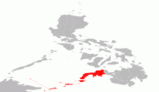
Zamboanga City (Zamboanga)
 |
 |
On October 12, 1936, Zamboanga became a chartered city under Commonwealth Act No. 39. It was inaugurated on February 26, 1937.
Zamboanga City is an independent, chartered city and was designated highly urbanized on November 22, 1983.
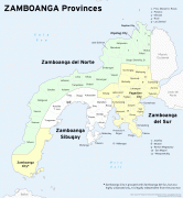
Although geographically separated, and an independent and chartered city, Zamboanga City is grouped with the province of Zamboanga del Sur for statistical purposes, yet governed independently from it.
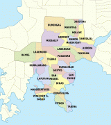
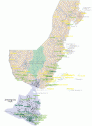
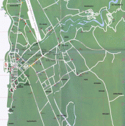
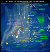
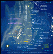
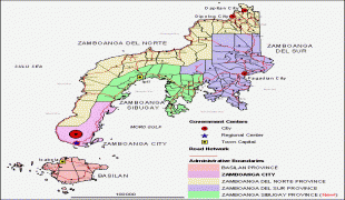
Map - Zamboanga City (Zamboanga)
Map


Country - Philippines
 |
 |
| Flag of the Philippines | |
Negritos, some of the archipelago's earliest inhabitants, were followed by successive waves of Austronesian peoples. Adoption of animism, Hinduism and Islam established island-kingdoms called Kedatuan, Rajahnates, and Sultanates. The arrival of Ferdinand Magellan, a Portuguese explorer leading a fleet for Spain, marked the beginning of Spanish colonization. In 1543, Spanish explorer Ruy López de Villalobos named the archipelago Las Islas Filipinas in honor of Philip II of Spain. Spanish settlement through Mexico, beginning in 1565, led to the Philippines becoming ruled by the Spanish Empire for more than 300 years. During this time, Catholicism became the dominant religion, and Manila became the western hub of trans-Pacific trade. In 1896, the Philippine Revolution began, which then became entwined with the 1898 Spanish–American War. Spain ceded the territory to the United States, while Filipino revolutionaries declared the First Philippine Republic. The ensuing Philippine–American War ended with the United States establishing control over the territory, which they maintained until the Japanese invasion of the islands during World War II. Following liberation, the Philippines became independent in 1946. Since then, the unitary sovereign state has often had a tumultuous experience with democracy, which included the overthrow of a decades-long dictatorship by a nonviolent revolution.
Currency / Language
| ISO | Currency | Symbol | Significant figures |
|---|---|---|---|
| PHP | Philippine peso | ₱ | 2 |
| ISO | Language |
|---|---|
| EN | English language |
| TL | Tagalog language |